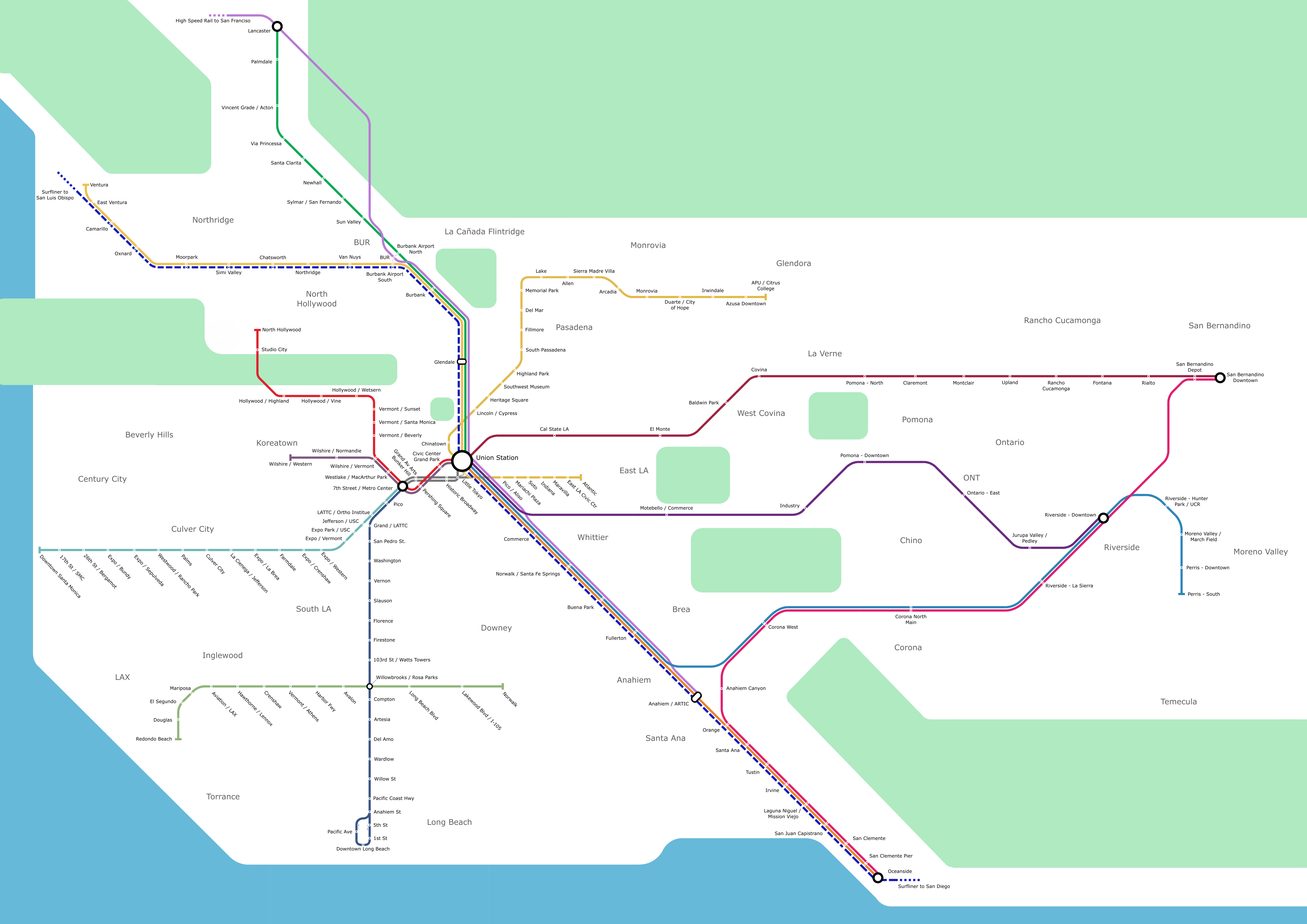
This is a map I made of the Los Angeles County rail system a couple of years ago! I just did this for fun, I have always been fascinated by maps of all sorts, and especially metro maps. I combined Amtrak, LA Metro, Metrolink, and the future CA High Speed Rail route all into one. I am not too happy with the proportions of the map, the valley is too small and the Simi Valley stop is where Van Nuys should be. Also, LA Metro and Metrolink operate on very different scales, so fitting it all in one map without squishing the metro was difficult.
The LA rail system has already changed a fair bit since I made this. The Regional Connector through DTLA has since opened (I got to ride it!), the new ‘K’ line has (partially) opened near LAX, and Metrolink opened their Arrow service in 2022. Soon, the ‘A’ line (the ‘L’ and the ‘A’ at the time I made this map), which is already the longest light rail line in the world, will be extended to include a station just next to the University of La Verne campus. The ‘D’ line extension phase 1 open this year as well.
Next year, the LAX peoplemover will (finally) open, along with a direct rail connection to LAX with the new ‘K’ line station.
