-
Healthy Food Policy Code Update Recommendations
•
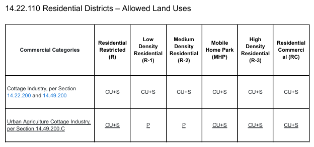
USP 542 Assignment 3 – Healthy Food Policy Code Update This class assignment involved proposing a handful of development code updates to the Cottage Grove, Oregon city code that would reduce barriers to urban agriculture. The code update proposals were based on recommendations in the Zoning for Urban Agriculture guide.
-
Zoning Analysis
•
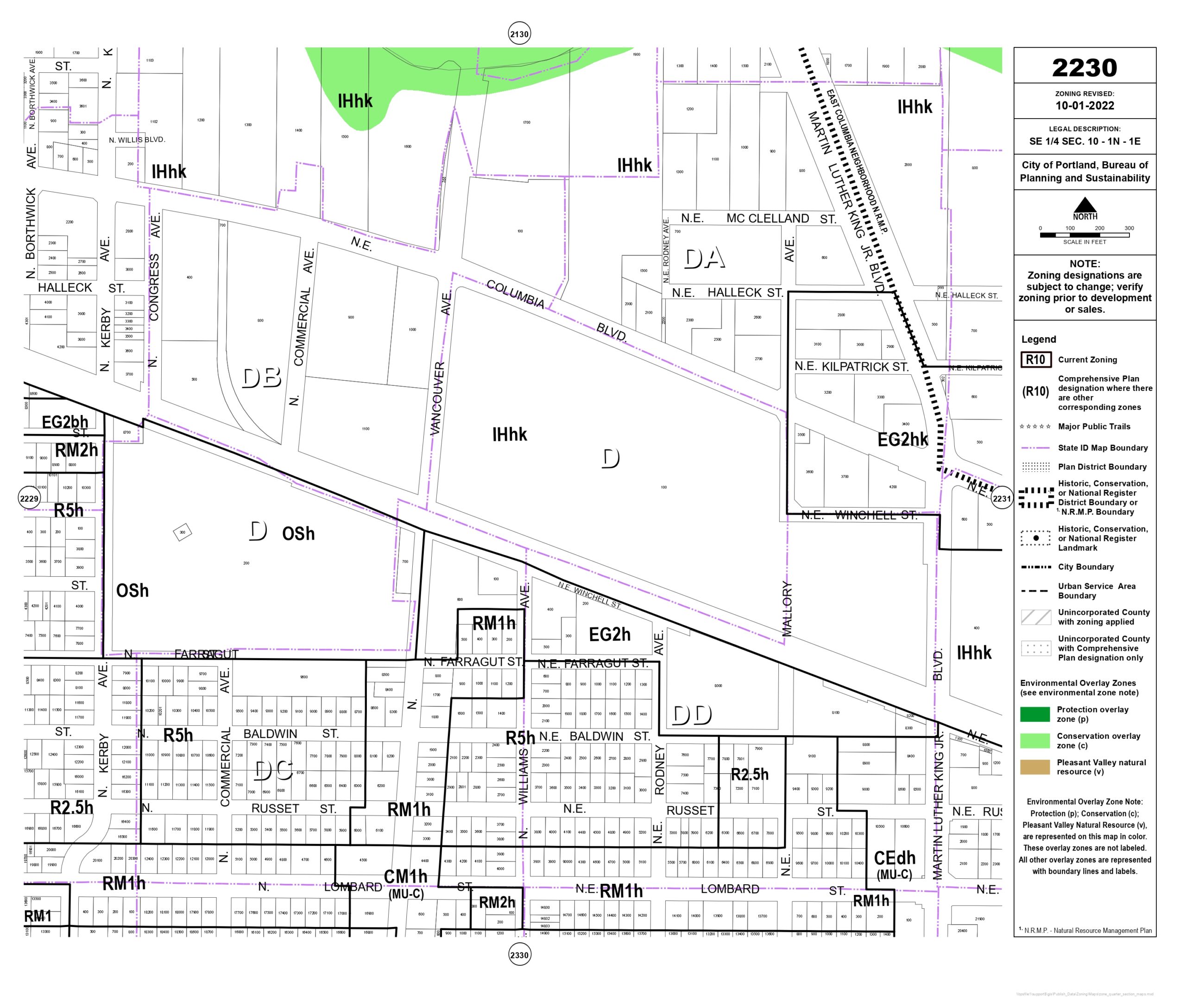
USP 542 Assignment 1 – Zoning Analysis For this assignment, I wrote a report analyzing the current land use for a property on N Lombard in Portland, Oregon. The report then discusses what uses are permitted on the property, and gives recommendations for how the site could be better utilized to both serve the…
-
Tempe EnVison Center Resilience Hub – Best Practices and Recommendations
•
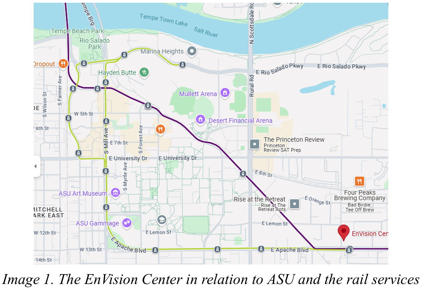
This is a short analysis of a resilience hub in Tempe, Arizona. As a part of the “Planning Methods I” course, we were tasked with locating and analyzing a resilience hub from outside of the Portland region. I studied the Tempe EnVison Center and highlighted some unique programs that could be adapted or applied…
-
Comprehensive Plan Implementation Analysis and Critique
•
Milwaukie, Oregon Course USP 540 – History and Theory of Planning Date December 9th, 2024 This assignment was the culmination of a number of shorter memos, analyses, and assignments related to our chosen plan. I chose to look at the comprehensive plan for the city of Milwaukie, Oregon, and this paper aims to critically…
-
Spatial Analysis of Green Development Features
•
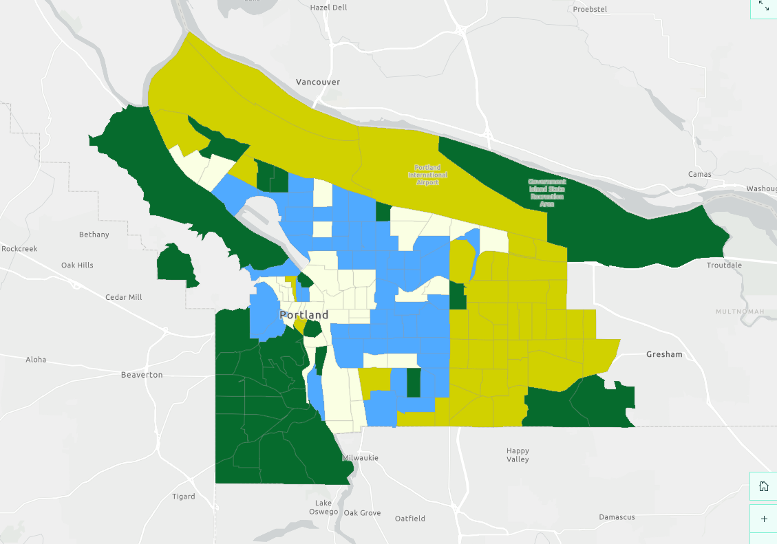
Spatially analyzing the relationship between green infrastructure and median household income in Portland, Oregon Ryan Gallo, Dylan Giliberto, Jacob Hagen, and Wally McAllister March 17, 2025
-
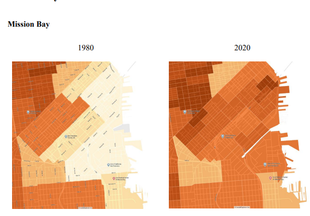
San Francisco Urban Inequality Analysis
•
Course USP 515 – Economic Applications for Urban Studies & Planning Date December 6th, 2024 This analysis looks at economic inequality on the San Francisco region. This is done by looking at the disparities in income and poverty rates by race. Furthermore, this paper looks at two specific neighborhoods on the SF peninsula and…
-
San Francisco Urban Density Analysis
•
Course USP 515 – Economic Applications for Urban Studies & Planning Date November 15, 2024 This assignment analyzed the urban density of the San Francisco region. Specifically, I looked at the SF Metro Division of the San Francisco – Oakland Metropolitan Statistical Area and compared the population and density between 1980, 2000, and 2020.…
-
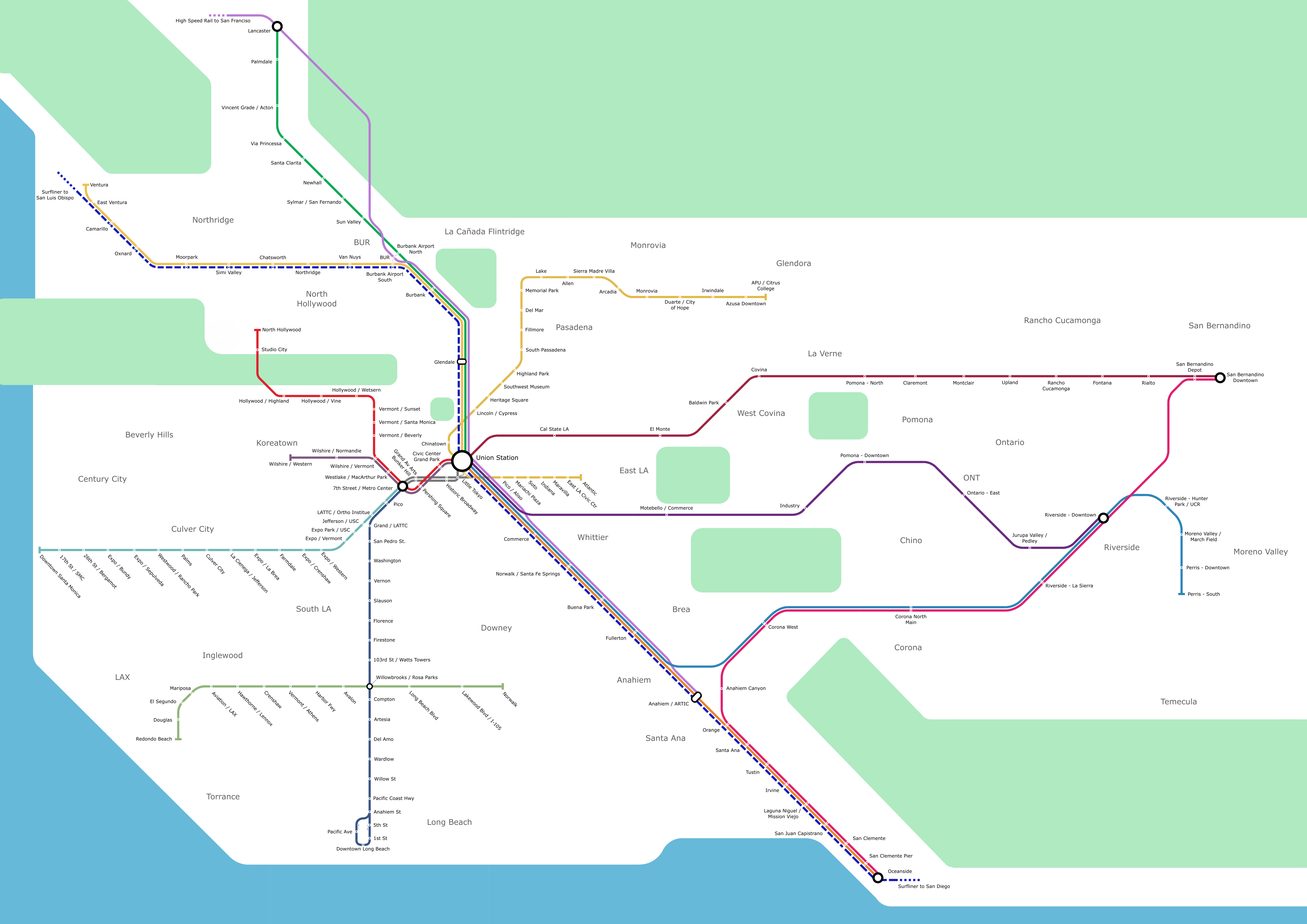
Custom Los Angeles Metro Map
•
This is a map I made of the Los Angeles County rail system a couple of years ago! I just did this for fun, I have always been fascinated by maps of all sorts, and especially metro maps. I combined Amtrak, LA Metro, Metrolink, and the future CA High Speed Rail route all into…